Silk WWII Double-Sided Escape Map
A silk World War II double sided escape map 42.52 in. x 24.61 in.

Gallipoli Map - WWI (1915)
A map of the Gallipoli area, World War I, colour lithograph, published by The Farmer & Settler, 1915, 29.92 in. x 39.37 in.

WWI Silk Embroidery: Souvenir of Egypt 1916
A framed silk World War I embroidery, with embroidered script 'Souvenir of Egypt 1916', a photo of a serviceman above a map and arms of Australia and the motto Advance Australia, 20.08 in. x 21.26 in.

World War I Australian Soldier's Memorabilia Collection
Archive - World War I Australian soldier of the 48th Battalion, AIF. Including trench art cigarette ashtray with German belt buckle, other German belt buckles, Australian & German jacket buttons, Australian insignia, German metal soap (Seife) container wit

WWI Memorabilia Collection
World War I 1st Anzac Corps position map, at Marc 1917, No.4 Coy Xmas 1917 dinner menu card (Flanders), NZEF map of Cairo, 60+ autographs of 2NZEF members

Boer War Map and Memorabilia
Boer War Map: Coloured lithograph supplement titled 'The Argus Map Of The Seat Of War In South Africa', published by Wilson & Mackinnon [Melb]. Framed and glazed. Map size 13.78 in. x 18.50 in. Together with photographs from the Boer War & 5 American…

WWII Airforce Escape Map for Captain Orton
World War II Airforce Escape map, presented to Captain L.E.A. Orton, print on silk 26.38 in. x 20.47 in.

WWII RAAF Silk Map: New Guinea Central
Australian World War II RAAF silk escape map, 'New Guinea central'

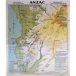
Anzac Peninsula Battlefields Map
Map of Anzac Peninsula Battlefields, colour print 14.57 in. x 11.02 in.

Gavrelle Trench Map: Western Front, 6 Miles from Arras
Trench map of Gavrelle, 6 Miles from Arras, Western front, print and pencil 12.60 in. x 16.93 in.