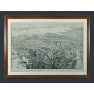
Fullwood's Sydney Map - Centennial Edition
Framed map city of Sydney, New South Wales. A H Fullwood. Centennial number of the Sydney mail, supplement to the Sydney mail January 21st,1888. Image (24.61 in. x 36.42 in.), frame (24.61 in. x 36.42 in. x 32.09 in. x 42.91 in.).

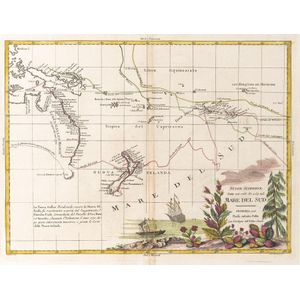
New Discoveries in the South Pacific
Nuove Scoperte, Fatte nel 1765, 67, e 69 nel, Mare Del Sud' by Antonio Zatta [Venice, 1776], window mounted, overall 22.44 in. x 19.29 in. Tooley 1431.

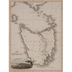
Van Diemens Land: Hobart Town View, 1824
Van Diemens Land with colour lithograph view of Hobart Town, drawn & engraved by Lizars, circa 1824. 8.66 in. x 11.81 in.

Captain Cook's Map of Christmas Island (1777)
Map of Christmas Island: 'Christmas Island, Discovered in the ships Resolution and Discovery 1777' by Captain Cook, from the English edition of Cook's Voyages (London,), attractive engraved map, overall 11.02 in. x 9.06 in.

Australia's First Map - Nicholas Vallard's Atlas (1547)
The first map of Australia from Nicholas Vallard's Atlas 1547 coloured lithograph 15.75 in. x 22.44 in. Provenance: Private Collection, NSW

Tallis' Maps: Port Phillip & England/Wales
John Tallis, Map of port Phillip and map of England and Wales

Angling in Troubled Waters lithograph
Fred W rose map - Angling in Troubled Waters - coloured lithograph 19.49 in. x 27.56 in.

Polychrome Map of Rome by Caftaldo (1734)
Framed polychrome map Roma Ni' Auc Fore Iacobo Caftaldo 1734 16.14 in. x 21.26 in.

Bleau's Polychrome Map of Northamptonshire, C1654
Framed polychrome map, Northamtonshire by Bleau, C1654 16.34 in. x 19.88 in.

Framed Map of Lochabria by Valk and Schenk
Framed polychrome map Lochabria by Gerardi Valk et Petri Schenk, Amftel'dami 20.87 in. x 23.62 in.