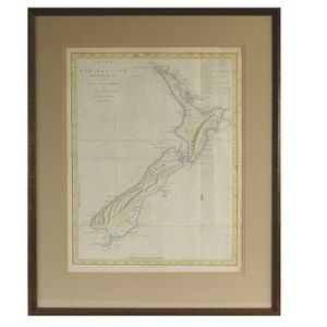
Cook's 1772 Chart of New Zealand
James Cook 'Chart of New Zealand...', rare original 1772 engraving by John Bayly from the official first edition Hawkesworth publication of Cook's Voyage. hand coloured in outline. 19.29 in. x 14.96 in. The first complete coastline chart of all New Zealand, showing the track of the Endeavour with dates and soundings. Although discovered by Tasman in 1642 it was Cook who discovered New Zealand was not part of the 'Terra Australis'. Cook took six months to circumnavigate the islands. Sailing east of Banks Peninsula he mistook it for an island, Stewart Island is marked as a peninsula.
You must be a subscriber, and be logged in to view price and dealer details.
Register Now to view actual auction price for this item.
This item has been included into following indexes:
