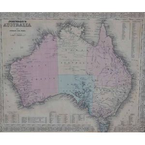
Antique Framed Maps: Australia & World with Cook's Routes
i) A 'Johnson's Australia' framed map, c.1864, by Johnson & Ward hand coloured engraved print. 12.60 in. x 15.75 in. (image); ii) 'The world on Mercator's Projection' framed map Published 1816 London, by C.S. Smith hand coloured engraved print note: showing Capt. Cooks voyage routes, with landing and departure dates. 12.60 in. x 15.75 in. x 10.55 in. x 13.98 in. (image)
You must be a subscriber, and be logged in to view price and dealer details.
Register Now to view actual auction price for this item.
This item has been included into following indexes:
